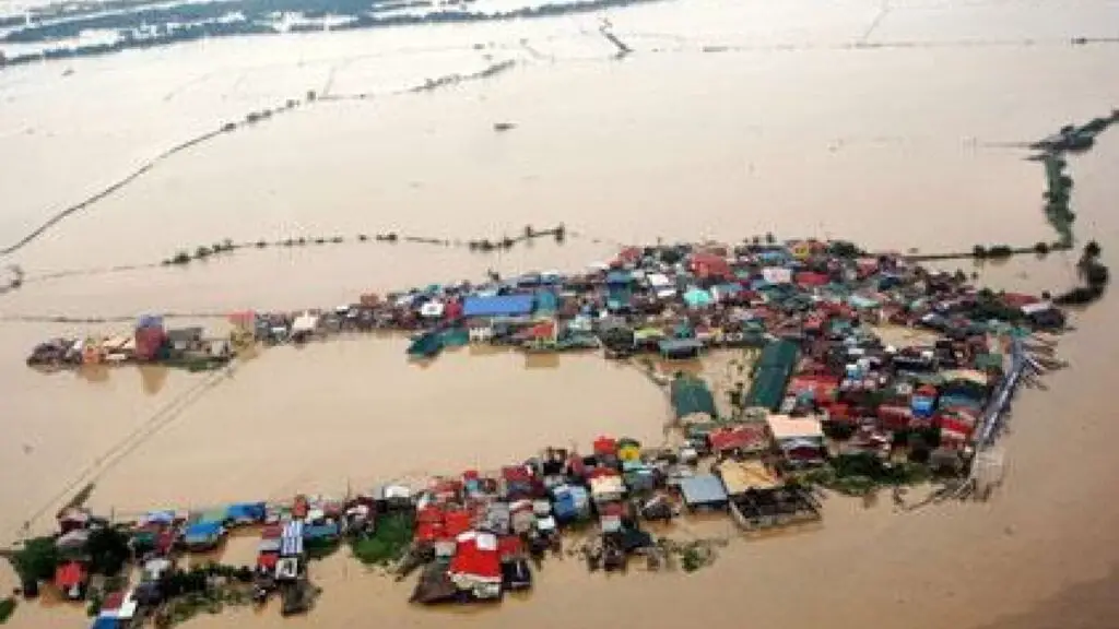
One of the nations in the globe that is vulnerable to typhoons and other weather disturbances is the Philippines. The main cause of this, according to the Philippine Atmospheric, Geophysical, and Astronomical Services Administration (PAGASA), is the country’s geographic location, which frequently results in heavy rains, widespread flooding, and high winds that cause severe damage to crops and property. In reality, the nation receives 20 tropical cyclones annually on average, with roughly 8 or 9 of them making landfall in different parts of the Philippines.
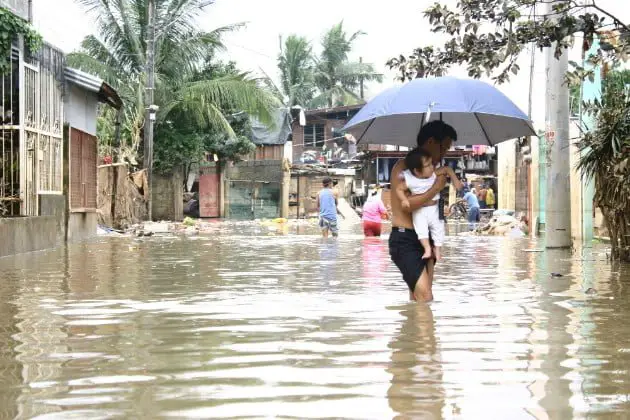
Because of this, it is apparent that the nation frequently faces persistent flooding, which seriously damages both property and human lives. The Philippines is listed as having the eighth-highest number of citizens exposed to serious flood hazards in the World Bank’s Policy Research Working Paper No. 9447, Persons in Harm’s Way: Flood Exposure and Poverty in 189 Countries. Almost 29 million people, or 27.7% of the total population of the nation, were at risk of flooding in just 2020. Because of this, it’s critical that everyone is informed of the various flood-prone regions in the Philippines.
In order to help you take the necessary precautions to mitigate the risks, we will provide some of the ways to learn about the various flood-prone areas in the nation. These ways include websites and applications that are useful, especially because the rainy season, which began on May 18, 2022, and continues today, 2023, has been made worse by the La Nia, which produced more precipitation than usual.
How to check if you are in Flood Zone?
Mapakalamidad.ph
On September 10, 2022, Mapakalamidad.ph, a web-based portal that offers crowdsourced and current flood information, made its formal debut. The website locates and maps flooded areas during disasters with the intention of assisting Filipinos during emergencies, particularly in periods of heavy rain.
Via the Mapakalamidad.ph, Filipinos today may get real-time information regarding the flooding circumstances and observe the severely flooded communities, municipality, and even as particular as the barangay on the map provided on the web-page. Information is gathered through numerous social media platforms because this website is crowdsourced. According to the verified reports, flooded areas will show up on the map to assist residents and emergency response teams in finding and identifying the locations that require an immediate disaster response. This website is also useful for drivers who need to determine the extent of the flood and whether they should look for alternative routes instead.
With the use of Mapakalamidad.ph’s color-coded flood warning features, you can quickly determine the real-time flood depth in areas hit by typhoons or monsoon-driven rain. Users can use the following alerts as a guide to calculate the flood depth:
- Red – greater than 150 cm
- Orange – 71-150 cm
- Yellow – 10-70 cm
Also, purple indicates that inhabitants and onlookers alike should proceed with caution.
The Office of Civil Defense’s PhilAWARE, which is also powered by the Pacific Disaster Center’s (PDC) hazard monitoring and early warning system DisasterAWARE, is a platform based in Indonesia called Yayasan Peta Bencana that creates real-time disaster maps using both crowd-sourced reporting and government agency validations.
The success and accuracy of this crowdsourcing platform depend greatly on the netizens because the website uses social media platforms to collect information. Facebook users can send photos, a location, and a description of the situation to Mapakalamidad.ph to report flood information in real time. Users of Telegram can report the flooding situation by sending a message with the subject /flood to @kalamidadbot.
Twitter users can contribute to the flood information reporting effort by tweeting the hashtag #flood to @mapakalamidad.
Project NOAH
In response to late President Benigno S. Aquino III’s call for a more accurate, integrated, and responsive disaster prevention and mitigation system, particularly in high-risk areas throughout the Philippines, the Department of Science and Technology (DOST) launched in 2013 the Nationwide Operational Assessment of Hazards, or simply known as Project NOAH.
The Project has the following components:
- Distribution of Hydrometeorological Devices in hard-hit areas in the Philippines (Hydromet);
- Disaster Risk Exposure Assessment for Mitigation – Light Detection and Ranging (DREAM-LIDAR) Project;
- Enhancing Geohazards Mapping through LIDAR;
- Coastal Hazards and Storm Surge Assessment and Mitigation (CHASSAM);
- Local Development of Doppler Radar Systems (LaDDeRS);
- Landslide Sensors Development Project;
- Weather Hazard Information Project (WHIP); and
- Flood Information Network (FloodNET) Project
The FloodNet, like the Mapakalamidad web page, the final component of Project NOAH, strives to deliver real-time and reliable information to flood early warning systems. Nonetheless, it is regrettable that the DOST-initiated Project NOAH was defunded in 2017 because, according to then-DOST Secretary Dela Pea, the Project’s promises had already been fulfilled and were now ready for various institutions such as the National Disaster Risk Reduction and Management Council (NDRRMC), PHILVOCs, and PAGASA to use and institutionalize.
Nonetheless, the University of the Philippines Resilience Institute was relaunched as the UP NOAH Center, and the Project NOAH webapp is still available at http://noah.up.edu.ph/.
PAGASA Flood Information
The Philippine Atmospheric, Geophysical, and Astronomical Services Administration (PAGASA) was the country’s first agency, and it is responsible for providing flood and typhoon warnings, public weather forecasts and advisories, meteorological, astronomical, climatological, and other specialized information and services. PAGASA was established on December 8, 1972, by Presidential Order No. 78, which reorganized the Philippine Weather Bureau into PAGASA.
Via its Flood Information section on its official website, PAGASA delivers reliable and real-time flood information to 18 main river basins in the country as well as Metro Manila Flood Monitoring.
In addition to the foregoing, the PAGASA has created flood forecasting and warning bulletin systems to advise the people of the impending disaster. PAGASA provides a warning at specific hours of the day during the flooding period until the flood subsides or all hazards and dangers associated with floods are no longer present, especially during periods of excessive precipitation. The operational environment in which flood forecasting and warning activities are carried out is defined by the current hydrometeorological situation in a given river basin. Conveniently divided into:
- Normal Situation
- Alert Phase
- Warning Phase
Conclusion
Whatever program or site you choose to check, knowing where are the flood zones can make your life much easier when you are building, constructing and choosing for the right location for your dream house.
To see other material construction, please see here.
To know other construction guides, tips, and methodology for beginners, veterans, and contractors, please see here.